
From quakes that rattle cities to storms that reshape coastlines, natural disasters are a dramatic meeting point of Earth science and human stories.
This big set of natural disaster trivia spans causes, famous events, safety know-how, and the tools we use to measure and forecast.
Start easy, then climb toward expert-level challenges.
Earthquakes & Seismic Science
Q: What instrument measures earthquake ground motion?
A: A seismometer (seismograph).
Q: Which magnitude scale is the modern standard for big quakes?
A: Moment magnitude (Mw).
Q: Which scale rates shaking by observed effects, I–XII?
A: Modified Mercalli Intensity.
Q: Which seismic waves arrive first at a station?
A: P-waves.
Q: What plate boundary type produces megathrust earthquakes?
A: Subduction zones.
Q: The “Ring of Fire” encircles which ocean?
A: The Pacific.
Q: What’s the world’s largest recorded earthquake by magnitude?
A: 1960 Valdivia, Chile (Mw 9.5).
Q: Magnitude vs. intensity—what’s the difference?
A: Energy released vs. local effects.
Q: What’s the term for soil behaving like a liquid during shaking?
A: Liquefaction.
Q: What is an aftershock?
A: A smaller quake following the mainshock.
Q: What’s an earthquake swarm?
A: Many small quakes without a single mainshock.
Q: What is a blind thrust fault?
A: A fault that doesn’t reach the surface.
Q: What’s often cited as the deadliest earthquake in history?
A: 1556 Shaanxi, China (estimates vary).

Volcanoes & Eruptions
Q: Broad, gently sloped volcano built from fluid basalt?
A: A shield volcano.
Q: Steep, layered volcano known for explosive eruptions?
A: A stratovolcano (composite volcano).
Q: What scale ranks eruption size from 0 to 8?
A: The Volcanic Explosivity Index (VEI).
Q: Fast, hot avalanches of gas and ash are called?
A: Pyroclastic flows.
Q: What do you call a mudflow of ash, water, and debris?
A: A lahar.
Q: Which eruption is often cited as the deadliest on record?
A: Mount Tambora, 1815.
Q: Which U.S. volcano had a destructive lateral blast in 1980?
A: Mount St. Helens.
Q: High-silica magma rich in… which rock leads to explosivity?
A: Rhyolite (silica-rich).
Q: The two common basaltic lava textures are ‘ā‘ā and…?
A: Pāhoehoe.
Q: How do large calderas typically form?
A: Collapse after magma chamber evacuation.
Q: Yellowstone is often described as what (informally)?
A: A “supervolcano.”
Q: Biggest 20th-century eruption by volume in North America?
A: Novarupta, Alaska, 1912.
Q: Which dissolved gas primarily drives explosive eruptions?
A: Water vapor (with other volatiles).
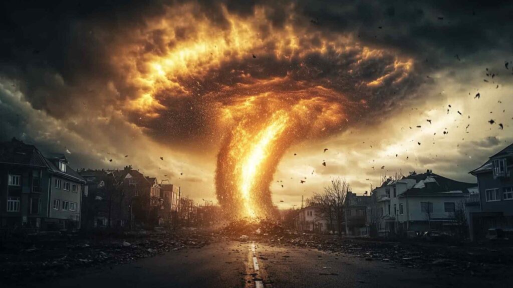
Hurricanes, Typhoons & Cyclones
Q: What are tropical cyclones called in the Atlantic?
A: Hurricanes.
Q: What’s the Northwest Pacific term for the same storms?
A: Typhoons.
Q: What fuels tropical cyclones energetically?
A: Warm oceans/latent heat release.
Q: What’s the calm center of the storm called?
A: The eye.
Q: Which scale classifies hurricanes by sustained wind?
A: The Saffir–Simpson scale.
Q: Rough minimum sea-surface temperature to sustain development?
A: ~26–27°C (79–81°F).
Q: In which hemisphere do cyclones spin clockwise?
A: The Southern Hemisphere.
Q: Why are tropical cyclones rare at the equator?
A: Weak Coriolis force.
Q: What’s “rapid intensification”?
A: ~30 kt wind increase in 24 hours.
Q: Historically, which hazard kills most in hurricanes?
A: Storm surge and flooding.
Q: Why are some storm names retired?
A: Exceptional death or damage.
Q: What do aircraft drop to sample a storm’s core?
A: Dropsondes.
Q: Which Atlantic storm is often cited as deadliest?
A: The Great Hurricane of 1780 (estimates vary).
Tornadoes & Severe Storms
Q: Which damage-based scale rates tornadoes EF0–EF5?
A: The Enhanced Fujita scale.
Q: “Tornado Alley” commonly refers to which U.S. region?
A: The Central Plains.
Q: The rotating updraft in a supercell is called a…?
A: Mesocyclone.
Q: What radar signature often hints at a tornadic storm?
A: A hook echo.
Q: Name the lowered, rotating feature beneath a supercell base.
A: A wall cloud.
Q: What’s a multi-vortex tornado?
A: A tornado with several subvortices.
Q: A waterspout is essentially a tornado occurring… where?
A: Over water.
Q: Tornado watch vs. warning—what’s the difference?
A: Favorable conditions vs. imminent/occurring.
Q: Safest place to shelter from a tornado?
A: Interior room/basement or storm shelter.
Q: The deadliest single U.S. tornado is often which one?
A: 1925 Tri-State Tornado.
Q: What’s a gustnado?
A: A small spin-up along a gust front.
Q: How does a landspout form differently?
A: Without a mesocyclone.
Q: Why are rain-wrapped tornadoes especially dangerous?
A: They’re hidden by precipitation.
Floods & Tsunamis
Q: What do we call sudden floods from intense rain?
A: Flash floods.
Q: A “100-year flood” actually means what?
A: 1% annual chance.
Q: What’s the primary purpose of a levee?
A: To contain high river water.
Q: What term describes a catastrophic dam-break surge?
A: An outburst flood.
Q: Most tsunamis are triggered by what?
A: Seafloor displacement from earthquakes.
Q: How fast can a tsunami travel in deep water?
A: Hundreds of mph (jetliner-like).
Q: Name a natural tsunami warning sign.
A: Rapid sea retreat after strong shaking.
Q: The 2004 megathrust tsunami struck which region?
A: The Indian Ocean (near Sumatra).
Q: Which event is often cited as the deadliest 20th-century disaster?
A: The 1931 China floods.
Q: How does storm surge differ from a tsunami?
A: Wind-driven rise vs. seismic wave.
Q: Debris flow vs. mudflow—key difference?
A: Coarser, denser mix vs. finer.
Q: Why does urbanization raise flood risk?
A: Impervious surfaces increase runoff.
Q: What ocean network detects tsunami waves directly?
A: DART buoy systems (with seismic data).
Wildfires & Fire Weather
Q: What are the three sides of the fire triangle?
A: Heat, fuel, oxygen.
Q: On what terrain do wildfires spread fastest?
A: Steep, up-slope hillsides.
Q: Wind-blown sparks and embers are called what?
A: Firebrands (ember attack).
Q: Surface fire vs. crown fire—main difference?
A: Ground fuels vs. treetops.
Q: Why conduct prescribed burns?
A: Reduce fuels, restore ecosystems.
Q: A Red Flag Warning signals what?
A: Critical fire-weather conditions.
Q: What are California’s hot, dry downslope winds called?
A: Santa Ana winds.
Q: Who are smokejumpers?
A: Parachuting wildland firefighters.
Q: What is the wildland–urban interface (WUI)?
A: Where homes meet wildlands.
Q: “Defensible space” refers to what?
A: Cleared zone around structures.
Q: Which event is often cited as the deadliest U.S. wildfire?
A: The 1871 Peshtigo Fire.
Q: How does fuel moisture affect fire behavior?
A: Drier fuels ignite/spread faster.
Q: Aerial firefighting planes drop what materials?
A: Water and retardant.
Droughts, Heatwaves & Climate Signals
Q: What’s the simplest definition of drought?
A: Prolonged water shortage vs. normal.
Q: Name three common drought types.
A: Meteorological, agricultural, hydrological.
Q: The heat index combines which variables?
A: Temperature and humidity.
Q: Why is wet-bulb temperature crucial for humans?
A: It limits evaporative cooling.
Q: What meteorological feature often causes heat waves?
A: High-pressure “heat domes.”
Q: El Niño typically does what to rainfall patterns?
A: Shifts them regionally.
Q: La Niña tends to do what?
A: Oppose El Niño’s tendencies.
Q: The 1930s U.S. drought is known as what?
A: The Dust Bowl.
Q: What is the urban heat island effect?
A: Cities warmer than surroundings.
Q: What does the Palmer Index track?
A: Long-term moisture anomalies.
Q: In many countries, which hazard is deadliest?
A: Heat waves.
Q: Monsoon failure often leads to what?
A: Severe regional drought.
Q: Water rationing is an example of what?
A: Drought adaptation/management.
Winter Storms, Ice & Cold
Q: U.S. blizzard criteria combine wind, visibility, and what duration?
A: At least three hours.
Q: A nor’easter typically tracks along which coastline?
A: The U.S. East Coast.
Q: Lake-effect snow requires what basic setup?
A: Cold air over warmer lakes.
Q: What is “black ice”?
A: Transparent glaze on pavement.
Q: Sleet vs. freezing rain—main difference?
A: Ice pellets vs. glaze on contact.
Q: Where does hail form?
A: In strong thunderstorm updrafts.
Q: What does wind chill represent?
A: Heat loss from exposed skin.
Q: The polar vortex resides mainly in which layer?
A: The stratosphere.
Q: Sudden stratospheric warming can do what?
A: Disrupt the polar vortex.
Q: A Snow Squall Warning implies what hazard?
A: Brief, intense whiteout conditions.
Q: Why are ice storms so damaging?
A: Heavy glaze on trees/lines.
Q: On which slope angles is avalanche risk highest?
A: Roughly 30–45 degrees.
Q: What three items form the avalanche safety “triad”?
A: Transceiver, probe, shovel.
Landslides & Mass Movements
Q: What’s a landslide, broadly defined?
A: Downslope movement of earth materials.
Q: Name common landslide triggers.
A: Heavy rain, earthquakes, volcanoes, human activity.
Q: Rockfall vs. rockslide—key difference?
A: Free fall vs. sliding mass.
Q: What is a debris flow like?
A: A fast, concrete-like slurry.
Q: What is a rotational slump?
A: Slide along a curved surface.
Q: Soil creep is best described how?
A: Very slow, persistent movement.
Q: Quick clay failures occur under what condition?
A: Sensitive clays liquefy when disturbed.
Q: The 1970 Huascarán disaster involved what?
A: A rock-ice avalanche.
Q: What caused the 1963 Vajont catastrophe?
A: Reservoir-triggered slope collapse.
Q: Which slopes are most susceptible to failure?
A: Steep, fractured, deforested hillsides.
Q: How do warnings for landslides often work?
A: Rainfall thresholds and ground sensors.
Q: How do drainage and retaining walls help?
A: Reduce pore pressure; stabilize slopes.
Q: Coastal bluff failures are accelerated by what?
A: Wave erosion and heavy rain.
Forecasting, Warning Systems & Safety
Q: What action phrase is recommended during earthquakes?
A: Drop, Cover, and Hold On.
Q: Is sheltering under a highway overpass safe in a tornado?
A: No—winds can intensify there.
Q: What should a go-bag include at minimum?
A: Water, meds, documents, flashlight.
Q: “Turn Around, Don’t Drown” warns against what?
A: Driving through floodwaters.
Q: What should you do after natural tsunami signs?
A: Go to high ground immediately.
Q: What do GOES-type satellites provide forecasters?
A: Continuous weather imagery.
Q: What does Doppler radar measure?
A: Precipitation and wind motion.
Q: What do “cones of uncertainty” communicate?
A: Possible storm-track spread.
Q: How does ensemble forecasting improve guidance?
A: Tests many model scenarios.
Q: What do Wireless Emergency Alerts deliver?
A: Urgent public warnings to phones.
Q: What does NOAA Weather Radio offer?
A: 24/7 local hazard alerts.
Q: Mitigation vs. response—key difference?
A: Risk reduction vs. immediate action.
Q: After a quake, what safety checks matter first?
A: Injuries, gas leaks, utilities.

Ellie Simons creates and edits Random Trivia. She researches trivia using primary and authoritative sources whenever possible and is currently reviewing the site's older trivia library for accuracy, clarity, and playability. Read more on the About page.
About this quiz
Site editor: Ellie Simons. Read our Trivia Methodology to learn how questions are researched and updated. Page last updated: . Report an error.