
From quakes that rattle cities to storms that reshape coastlines, natural disasters are a dramatic meeting point of Earth science and human stories.
This big set of natural disaster trivia spans causes, famous events, safety know-how, and the tools we use to measure and forecast.
Start easy, then climb toward expert-level challenges.
Earthquakes & Seismic Science
Q: What instrument measures earthquake ground motion?
A: A seismometer (seismograph).
Q: Which magnitude scale is the modern standard for big quakes?
A: Moment magnitude (Mw).
Q: Which scale rates shaking by observed effects, I–XII?
A: Modified Mercalli Intensity.
Q: Which seismic waves arrive first at a station?
A: P-waves.
Q: What plate boundary type produces megathrust earthquakes?
A: Subduction zones.
Q: The “Ring of Fire” encircles which ocean?
A: The Pacific.
Q: What’s the world’s largest recorded earthquake by magnitude?
A: 1960 Valdivia, Chile (Mw 9.5).
Q: Magnitude vs. intensity—what’s the difference?
A: Energy released vs. local effects.
Q: What’s the term for soil behaving like a liquid during shaking?
A: Liquefaction.
Q: What is an aftershock?
A: A smaller quake following the mainshock.
Q: What’s an earthquake swarm?
A: Many small quakes without a single mainshock.
Q: What is a blind thrust fault?
A: A fault that doesn’t reach the surface.
Q: What’s often cited as the deadliest earthquake in history?
A: 1556 Shaanxi, China (estimates vary).

Volcanoes & Eruptions
Q: Broad, gently sloped volcano built from fluid basalt?
A: A shield volcano.
Q: Steep, layered volcano known for explosive eruptions?
A: A stratovolcano (composite volcano).
Q: What scale ranks eruption size from 0 to 8?
A: The Volcanic Explosivity Index (VEI).
Q: Fast, hot avalanches of gas and ash are called?
A: Pyroclastic flows.
Q: What do you call a mudflow of ash, water, and debris?
A: A lahar.
Q: Which eruption is often cited as the deadliest on record?
A: Mount Tambora, 1815.
Q: Which U.S. volcano had a destructive lateral blast in 1980?
A: Mount St. Helens.
Q: High-silica magma rich in… which rock leads to explosivity?
A: Rhyolite (silica-rich).
Q: The two common basaltic lava textures are ‘ā‘ā and…?
A: Pāhoehoe.
Q: How do large calderas typically form?
A: Collapse after magma chamber evacuation.
Q: Yellowstone is often described as what (informally)?
A: A “supervolcano.”
Q: Biggest 20th-century eruption by volume in North America?
A: Novarupta, Alaska, 1912.
Q: Which dissolved gas primarily drives explosive eruptions?
A: Water vapor (with other volatiles).
Hurricanes, Typhoons & Cyclones
Q: What are tropical cyclones called in the Atlantic?
A: Hurricanes.
Q: What’s the Northwest Pacific term for the same storms?
A: Typhoons.
Q: What fuels tropical cyclones energetically?
A: Warm oceans/latent heat release.
Q: What’s the calm center of the storm called?
A: The eye.
Q: Which scale classifies hurricanes by sustained wind?
A: The Saffir–Simpson scale.
Q: Rough minimum sea-surface temperature to sustain development?
A: ~26–27°C (79–81°F).
Q: In which hemisphere do cyclones spin clockwise?
A: The Southern Hemisphere.
Q: Why are tropical cyclones rare at the equator?
A: Weak Coriolis force.
Q: What’s “rapid intensification”?
A: ~30 kt wind increase in 24 hours.
Q: Historically, which hazard kills most in hurricanes?
A: Storm surge and flooding.
Q: Why are some storm names retired?
A: Exceptional death or damage.
Q: What do aircraft drop to sample a storm’s core?
A: Dropsondes.
Q: Which Atlantic storm is often cited as deadliest?
A: The Great Hurricane of 1780 (estimates vary).
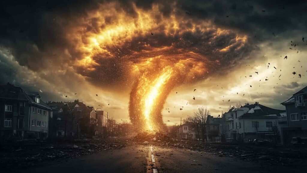
Tornadoes & Severe Storms
Q: Which damage-based scale rates tornadoes EF0–EF5?
A: The Enhanced Fujita scale.
Q: “Tornado Alley” commonly refers to which U.S. region?
A: The Central Plains.
Q: The rotating updraft in a supercell is called a…?
A: Mesocyclone.
Q: What radar signature often hints at a tornadic storm?
A: A hook echo.
Q: Name the lowered, rotating feature beneath a supercell base.
A: A wall cloud.
Q: What’s a multi-vortex tornado?
A: A tornado with several subvortices.
Q: A waterspout is essentially a tornado occurring… where?
A: Over water.
Q: Tornado watch vs. warning—what’s the difference?
A: Favorable conditions vs. imminent/occurring.
Q: Safest place to shelter from a tornado?
A: Interior room/basement or storm shelter.
Q: The deadliest single U.S. tornado is often which one?
A: 1925 Tri-State Tornado.
Q: What’s a gustnado?
A: A small spin-up along a gust front.
Q: How does a landspout form differently?
A: Without a mesocyclone.
Q: Why are rain-wrapped tornadoes especially dangerous?
A: They’re hidden by precipitation.
Floods & Tsunamis
Q: What do we call sudden floods from intense rain?
A: Flash floods.
Q: A “100-year flood” actually means what?
A: 1% annual chance.
Q: What’s the primary purpose of a levee?
A: To contain high river water.
Q: What term describes a catastrophic dam-break surge?
A: An outburst flood.
Q: Most tsunamis are triggered by what?
A: Seafloor displacement from earthquakes.
Q: How fast can a tsunami travel in deep water?
A: Hundreds of mph (jetliner-like).
Q: Name a natural tsunami warning sign.
A: Rapid sea retreat after strong shaking.
Q: The 2004 megathrust tsunami struck which region?
A: The Indian Ocean (near Sumatra).
Q: Which event is often cited as the deadliest 20th-century disaster?
A: The 1931 China floods.
Q: How does storm surge differ from a tsunami?
A: Wind-driven rise vs. seismic wave.
Q: Debris flow vs. mudflow—key difference?
A: Coarser, denser mix vs. finer.
Q: Why does urbanization raise flood risk?
A: Impervious surfaces increase runoff.
Q: What ocean network detects tsunami waves directly?
A: DART buoy systems (with seismic data).
Wildfires & Fire Weather
Q: What are the three sides of the fire triangle?
A: Heat, fuel, oxygen.
Q: On what terrain do wildfires spread fastest?
A: Steep, up-slope hillsides.
Q: Wind-blown sparks and embers are called what?
A: Firebrands (ember attack).
Q: Surface fire vs. crown fire—main difference?
A: Ground fuels vs. treetops.
Q: Why conduct prescribed burns?
A: Reduce fuels, restore ecosystems.
Q: A Red Flag Warning signals what?
A: Critical fire-weather conditions.
Q: What are California’s hot, dry downslope winds called?
A: Santa Ana winds.
Q: Who are smokejumpers?
A: Parachuting wildland firefighters.
Q: What is the wildland–urban interface (WUI)?
A: Where homes meet wildlands.
Q: “Defensible space” refers to what?
A: Cleared zone around structures.
Q: Which event is often cited as the deadliest U.S. wildfire?
A: The 1871 Peshtigo Fire.
Q: How does fuel moisture affect fire behavior?
A: Drier fuels ignite/spread faster.
Q: Aerial firefighting planes drop what materials?
A: Water and retardant.
Droughts, Heatwaves & Climate Signals
Q: What’s the simplest definition of drought?
A: Prolonged water shortage vs. normal.
Q: Name three common drought types.
A: Meteorological, agricultural, hydrological.
Q: The heat index combines which variables?
A: Temperature and humidity.
Q: Why is wet-bulb temperature crucial for humans?
A: It limits evaporative cooling.
Q: What meteorological feature often causes heat waves?
A: High-pressure “heat domes.”
Q: El Niño typically does what to rainfall patterns?
A: Shifts them regionally.
Q: La Niña tends to do what?
A: Oppose El Niño’s tendencies.
Q: The 1930s U.S. drought is known as what?
A: The Dust Bowl.
Q: What is the urban heat island effect?
A: Cities warmer than surroundings.
Q: What does the Palmer Index track?
A: Long-term moisture anomalies.
Q: In many countries, which hazard is deadliest?
A: Heat waves.
Q: Monsoon failure often leads to what?
A: Severe regional drought.
Q: Water rationing is an example of what?
A: Drought adaptation/management.
Winter Storms, Ice & Cold
Q: U.S. blizzard criteria combine wind, visibility, and what duration?
A: At least three hours.
Q: A nor’easter typically tracks along which coastline?
A: The U.S. East Coast.
Q: Lake-effect snow requires what basic setup?
A: Cold air over warmer lakes.
Q: What is “black ice”?
A: Transparent glaze on pavement.
Q: Sleet vs. freezing rain—main difference?
A: Ice pellets vs. glaze on contact.
Q: Where does hail form?
A: In strong thunderstorm updrafts.
Q: What does wind chill represent?
A: Heat loss from exposed skin.
Q: The polar vortex resides mainly in which layer?
A: The stratosphere.
Q: Sudden stratospheric warming can do what?
A: Disrupt the polar vortex.
Q: A Snow Squall Warning implies what hazard?
A: Brief, intense whiteout conditions.
Q: Why are ice storms so damaging?
A: Heavy glaze on trees/lines.
Q: On which slope angles is avalanche risk highest?
A: Roughly 30–45 degrees.
Q: What three items form the avalanche safety “triad”?
A: Transceiver, probe, shovel.
Landslides & Mass Movements
Q: What’s a landslide, broadly defined?
A: Downslope movement of earth materials.
Q: Name common landslide triggers.
A: Heavy rain, earthquakes, volcanoes, human activity.
Q: Rockfall vs. rockslide—key difference?
A: Free fall vs. sliding mass.
Q: What is a debris flow like?
A: A fast, concrete-like slurry.
Q: What is a rotational slump?
A: Slide along a curved surface.
Q: Soil creep is best described how?
A: Very slow, persistent movement.
Q: Quick clay failures occur under what condition?
A: Sensitive clays liquefy when disturbed.
Q: The 1970 Huascarán disaster involved what?
A: A rock-ice avalanche.
Q: What caused the 1963 Vajont catastrophe?
A: Reservoir-triggered slope collapse.
Q: Which slopes are most susceptible to failure?
A: Steep, fractured, deforested hillsides.
Q: How do warnings for landslides often work?
A: Rainfall thresholds and ground sensors.
Q: How do drainage and retaining walls help?
A: Reduce pore pressure; stabilize slopes.
Q: Coastal bluff failures are accelerated by what?
A: Wave erosion and heavy rain.
Forecasting, Warning Systems & Safety
Q: What action phrase is recommended during earthquakes?
A: Drop, Cover, and Hold On.
Q: Is sheltering under a highway overpass safe in a tornado?
A: No—winds can intensify there.
Q: What should a go-bag include at minimum?
A: Water, meds, documents, flashlight.
Q: “Turn Around, Don’t Drown” warns against what?
A: Driving through floodwaters.
Q: What should you do after natural tsunami signs?
A: Go to high ground immediately.
Q: What do GOES-type satellites provide forecasters?
A: Continuous weather imagery.
Q: What does Doppler radar measure?
A: Precipitation and wind motion.
Q: What do “cones of uncertainty” communicate?
A: Possible storm-track spread.
Q: How does ensemble forecasting improve guidance?
A: Tests many model scenarios.
Q: What do Wireless Emergency Alerts deliver?
A: Urgent public warnings to phones.
Q: What does NOAA Weather Radio offer?
A: 24/7 local hazard alerts.
Q: Mitigation vs. response—key difference?
A: Risk reduction vs. immediate action.
Q: After a quake, what safety checks matter first?
A: Injuries, gas leaks, utilities.
Ellie Ewert is the founder and author of RandomTrivia.co, blending her passion for research with years of experience in content creation to deliver accurate, engaging, and well-sourced trivia. Dedicated to providing readers with trustworthy and entertaining facts, she applies meticulous fact-checking and SEO expertise to ensure every article meets the highest standards. Read more about our high standards in our Editorial Guidelines.