
Forecast: a 100 percent chance of trivia. These 120 weather questions cover clouds, rain, snow, thunderstorms, tornadoes, hurricanes, wind, temperature, forecasting, weather instruments, rainbows, halos, fog, pressure, jet streams, and the atmospheric science behind everything from a gentle drizzle to a supercell.
Weather Basics, Temperature & Air Pressure
Q: What layer of Earth's atmosphere contains most everyday weather?
A: The troposphere, the lowest major atmospheric layer.
Q: What is weather?
A: The short-term state of the atmosphere at a particular place and time.
Q: How is climate different from weather?
A: Climate describes long-term patterns, while weather describes short-term atmospheric conditions.
Q: What instrument measures air temperature?
A: A thermometer.
Q: What instrument measures atmospheric pressure?
A: A barometer.
Q: What instrument measures wind speed?
A: An anemometer.
Q: What instrument shows wind direction?
A: A wind vane, also called a weather vane.
Q: What instrument measures humidity?
A: A hygrometer.
Q: What instrument measures rainfall?
A: A rain gauge.
Q: What does relative humidity describe?
A: The amount of water vapor present compared with the maximum possible at that temperature.
Q: What is the dew point?
A: The temperature at which air becomes saturated and condensation can begin.
Q: Why can a high dew point feel muggy?
A: Moist air slows evaporation of sweat from your skin.
Q: What happens to air pressure as altitude increases?
A: It generally decreases because less atmosphere is above you.
Q: What pressure pattern is commonly associated with sinking air and fair weather?
A: High pressure.
Q: What pressure pattern is commonly associated with rising air and unsettled weather?
A: Low pressure.
Q: What is a weather front?
A: A boundary between air masses with different temperatures, moisture, or density.
Q: How is a cold front commonly drawn on a weather map?
A: As a blue line with triangles pointing in its direction of movement.
Q: How is a warm front commonly drawn?
A: As a red line with semicircles pointing in its direction of movement.
Q: What is an occluded front?
A: A front formed when a cold front catches a warm front and lifts the warm air.
Q: What is a stationary front?
A: A boundary between air masses that moves very little.
Q: What causes wind?
A: Air moves because of pressure differences, largely driven by uneven heating of Earth.
Q: What effect curves large-scale winds because Earth rotates?
A: The Coriolis effect.
Q: Does the Coriolis effect reliably determine how a household sink drains?
A: No. Sink shape and existing water motion dominate at that small scale.
Q: What are trade winds?
A: Persistent tropical easterly winds that blow toward the equatorial low-pressure region.
Q: What are prevailing westerlies?
A: Mid-latitude winds that generally move from west to east.
Q: What is the jet stream?
A: A narrow band of strong upper-atmosphere winds that helps steer weather systems.
Q: What does the heat index estimate?
A: How hot conditions feel when humidity is combined with air temperature.
Q: What does wind chill estimate?
A: How cold exposed skin feels because wind increases heat loss.
Q: At what temperature are Celsius and Fahrenheit equal?
A: Minus 40 degrees.
Q: What is a temperature inversion?
A: A layer where temperature rises with height, sometimes trapping cooler air and pollution below.
Clouds, Rain, Snow & Optical Weather
Q: What are clouds made of?
A: Tiny liquid water droplets, ice crystals, or a mixture of both.
Q: What cloud type is tall, towering, and associated with thunderstorms?
A: Cumulonimbus.
Q: What cloud type often looks like fluffy cotton heaps?
A: Cumulus.
Q: What cloud type forms a low, widespread gray layer?
A: Stratus.
Q: What high clouds often look thin and wispy?
A: Cirrus clouds.
Q: What does “nimbus” suggest in a cloud name?
A: Precipitation.
Q: What cloud commonly brings widespread steady rain or snow?
A: Nimbostratus.
Q: Why do clouds often form when air rises?
A: Rising air expands and cools, allowing water vapor to condense.
Q: What are cloud condensation nuclei?
A: Tiny particles such as salt, dust, or smoke on which water can condense.
Q: What is precipitation?
A: Water falling from clouds as rain, snow, sleet, hail, or another form.
Q: What largely determines whether precipitation reaches the ground as rain or snow?
A: The temperature profile from the cloud to the surface.
Q: What is sleet in common U.S. weather terminology?
A: Small ice pellets formed when melted snow refreezes before reaching the ground.
Q: What is freezing rain?
A: Liquid rain that freezes when it touches surfaces at or below freezing.
Q: Why can freezing rain cause major damage?
A: It coats roads, trees, and power lines with heavy, slippery ice.
Q: How does hail form?
A: Strong thunderstorm updrafts carry ice through supercooled water, building layers of ice.
Q: Does hail require freezing temperatures at ground level?
A: No. Hail can reach the ground during warm weather.
Q: What is virga?
A: Precipitation that evaporates or sublimates before reaching the ground.
Q: What is fog?
A: A cloud at or very near the ground.
Q: What is radiation fog?
A: Fog formed when the ground cools nearby moist air, often on clear calm nights.
Q: What is advection fog?
A: Fog formed when moist air moves over a colder surface and cools to saturation.
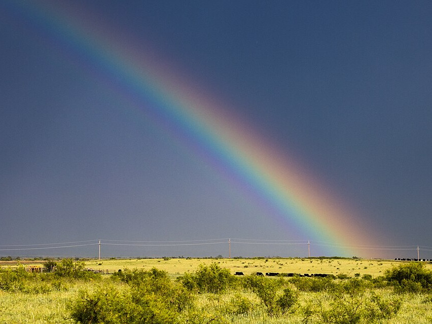
Q: What creates a rainbow?
A: Refraction, internal reflection, and dispersion of sunlight inside water droplets.
Q: What color is on the outer edge of a primary rainbow?
A: Red.
Q: What color is on the inner edge of a primary rainbow?
A: Violet.
Q: Why are colors reversed in a secondary rainbow?
A: Light undergoes an extra internal reflection inside the droplets.
Q: Where is the Sun when you see a rainbow ahead of you?
A: Behind you.
Q: What causes many halos around the Sun or Moon?
A: Light refracting and reflecting through ice crystals in high clouds.
Q: What are sundogs?
A: Bright spots beside the Sun produced by light interacting with ice crystals.
Q: What is a glory?
A: Colored rings around an observer's shadow on cloud or mist.
Q: Why can very cold snow squeak underfoot?
A: Cold, hard snow crystals fracture and rub together differently than warmer snow.
Q: Is “no two snowflakes are alike” a strict physical law?
A: No. Snow crystals are extraordinarily varied, but uniqueness is not a formal law.
Thunderstorms, Tornadoes & Hurricanes
Q: What three ingredients commonly help thunderstorms form?
A: Moisture, atmospheric instability, and a lifting mechanism.
Q: What causes thunder?
A: Lightning rapidly heats air, making it expand and create a powerful shock wave.
Q: Why do you see lightning before hearing thunder?
A: Light travels much faster than sound.
Q: How can you roughly estimate lightning distance in miles?
A: Count seconds from flash to thunder and divide by about five.
Q: Can lightning strike outside the area where rain is falling?
A: Yes. Lightning can extend many miles from a thunderstorm.
Q: What is cloud-to-ground lightning?
A: An electrical discharge between a cloud and the ground.
Q: What is intracloud lightning?
A: An electrical discharge that occurs within one cloud.
Q: What is a supercell?
A: A long-lived thunderstorm with a persistent rotating updraft.
Q: What is a mesocyclone?
A: A rotating region within a thunderstorm's updraft.
Q: Do all supercells produce tornadoes?
A: No. Many supercells never produce a tornado.
Q: What is a tornado?
A: A violently rotating column of air extending from a thunderstorm to the ground.
Q: What scale rates U.S. tornado damage?
A: The Enhanced Fujita scale, from EF0 through EF5.
Q: Is an EF rating usually a direct instrument measurement of peak wind?
A: No. It is generally estimated from damage indicators.
Q: What is Tornado Alley?
A: A popular name for a broad central U.S. region historically associated with frequent tornadoes.
Q: Can tornadoes happen outside Tornado Alley?
A: Yes. They occur in many regions of the United States and around the world.
Q: What is a waterspout?
A: A rotating column of air over water, with both fair-weather and tornadic varieties.
Q: What is a tropical cyclone?
A: An organized rotating storm system that develops over warm tropical or subtropical water.
Q: What is a hurricane?
A: An Atlantic or eastern North Pacific tropical cyclone with sustained winds of at least 74 mph.
Q: What is the same type of storm commonly called in the western North Pacific?
A: A typhoon.
Q: What is the eye of a hurricane?
A: The relatively calm center of a mature tropical cyclone.
Q: What is the eyewall?
A: The ring of intense thunderstorms surrounding the eye, often containing the strongest winds.
Q: What fuels a tropical cyclone?
A: Heat and moisture from warm ocean water, released through condensation in thunderstorms.
Q: Why do hurricanes usually weaken over land?
A: They lose their warm-ocean energy source and encounter greater friction and disrupted circulation.
Q: What is storm surge?
A: An abnormal rise of seawater pushed toward shore by a storm.
Q: Why is storm surge dangerous?
A: It can rapidly inundate coastal communities with deep, fast-moving seawater.
Q: What scale categorizes Atlantic hurricanes by maximum sustained wind?
A: The Saffir-Simpson Hurricane Wind Scale.
Q: How many categories are on the Saffir-Simpson scale?
A: Five, numbered Category 1 through Category 5.
Q: Does hurricane category directly measure rainfall or storm surge?
A: No. It is based on maximum sustained wind speed.
Q: What is rapid intensification?
A: An increase in a tropical cyclone's maximum sustained winds of at least 30 knots in 24 hours.
Q: Why are some hurricane names retired?
A: Particularly deadly or costly storm names may be retired to avoid insensitive reuse and confusion.
Forecasting, Records & Weird Weather
Q: What is a meteorologist?
A: A scientist or trained professional who studies the atmosphere and weather.
Q: What does weather radar detect especially well?
A: Precipitation and storm structure.
Q: What extra information does Doppler radar provide?
A: Motion toward or away from the radar, helping reveal wind patterns and rotation.
Q: What do weather satellites observe?
A: Clouds, moisture, temperatures, storms, atmospheric motion, and other large-scale conditions from space.
Q: Why are weather balloons launched?
A: To sample temperature, humidity, pressure, and winds through the atmosphere.
Q: What instrument package is commonly carried by a weather balloon?
A: A radiosonde.
Q: What is a numerical weather prediction model?
A: A computer simulation that uses atmospheric observations and physics to forecast future conditions.
Q: Why do forecasts usually become less certain farther into the future?
A: Small uncertainties in the atmosphere grow as models project conditions forward.
Q: What is an ensemble forecast?
A: A group of model runs with slightly different starting conditions or model setups.
Q: What does a 40 percent chance of precipitation mean?
A: There is a 40 percent probability of measurable precipitation at a given point in the forecast area during the stated period.
Q: What is the basic difference between a weather watch and a warning?
A: A watch means hazardous weather is possible; a warning means it is occurring or imminent.
Q: What does a severe thunderstorm watch mean?
A: Conditions are favorable for severe thunderstorms in and near the watch area.
Q: What does a tornado warning mean?
A: A tornado has been detected or strongly indicated and people in the warned area should take shelter.
Q: What is a blizzard?
A: A storm defined by strong winds and severely reduced visibility in blowing or falling snow for a sustained period.
Q: What is a drought?
A: A prolonged period of abnormally dry conditions that causes water shortages or other impacts.
Q: What is a heat wave?
A: A prolonged period of unusually hot weather for a particular region and season.
Q: What is lake-effect snow?
A: Snow produced when cold air moves over relatively warmer open lake water and gains heat and moisture.
Q: What is a Chinook wind?
A: A warm, dry downslope wind that can rapidly raise temperatures on the lee side of mountains.
Q: What is a sea breeze?
A: Daytime wind from water toward land caused by land heating faster than water.
Q: What is a land breeze?
A: A wind from land toward water that often develops at night when land cools faster.
Q: What is a monsoon?
A: A seasonal reversal or major shift in winds that produces pronounced wet and dry seasons.
Q: What is a microburst?
A: A small, intense downdraft that hits the ground and spreads damaging winds outward.
Q: What is a downburst?
A: Strong downward-moving air from a thunderstorm that produces damaging straight-line winds at the surface.
Q: What is a haboob?
A: A powerful wall of blowing dust, often generated by thunderstorm outflow in dry regions.
Q: What is graupel?
A: Soft ice pellets formed when supercooled droplets freeze onto falling snow crystals.
Q: What is thundersnow?
A: A thunderstorm that produces snow instead of ordinary rain.
Q: What is St. Elmo's fire?
A: A glowing electrical discharge that can appear on pointed objects during strong atmospheric electric fields.
Q: Does a greenish sky guarantee a tornado?
A: No. Green skies can occur with severe storms, but the color does not guarantee a tornado.
Q: What temperature does the World Meteorological Organization recognize as Earth's highest recorded air temperature?
A: 134°F, or 56.7°C, measured at Furnace Creek in Death Valley in 1913.
Q: Why does weather-station placement matter?
A: Nearby pavement, buildings, shade, and poor exposure can bias temperature, wind, and precipitation measurements.
How Did You Score?
If you knew your virga from your graupel, your eyewall from your eye, and your radiosonde from your rain gauge, your forecast is looking excellent.

Ellie Simons creates and edits Random Trivia. She researches trivia using primary and authoritative sources whenever possible and is currently reviewing the site's older trivia library for accuracy, clarity, and playability. Read more on the About page.
Explore more questions in our science trivia guide.
About this quiz
Site editor: Ellie Simons. Read our Trivia Methodology to learn how questions are researched and updated. Page last updated: . Report an error.